Scale: 1∆ to 5∆
Twistiness Pavement Quality Scenery
Panoramic Highway ∆∆∆∆∆ ∆∆ ∆∆∆∆∆
Highway 1 ∆∆∆∆ ∆∆∆ ∆∆∆∆∆
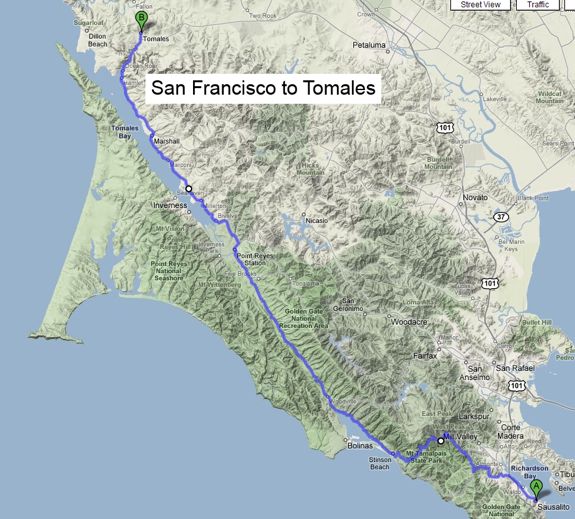
Note that Highway 1 is very popular in the summer. Traffic near Stinson Beach can turn desperately slow in the afternoons. Stay away if you are prone to bouts of road rage. The best time to drive this Porsche road is early in the morning. There can be coastal fog, but it only adds to the charm.
With temperatures hitting record highs around the East and South Bay, it is time to head north for the cool climes of Marin County and the Pacific Coast. Beautiful drive to Tomales, so don't forget a sweatshirt or a jacket.
From Highway 101, north of the Golden Gate Bridge, take the Stinson Beach exit and head on east on Shoreline Highway. The traffic light at Tamalpais Valley Junction is the last one we will see for a long time. A mile or so after the light, two road signs are worth our attention: the first one signals the end of the 35 mile an hour limit, and the second one advertises 10 miles of curves. The road is lined with enormous eucalyptus trees and at mile 3 we enter the Golden Gate National Recreation Area. Soon after that, it is time to turn right onto Panoramic Highway for our first treat: 9 miles of tight turns and switchbacks around the Mount Tamalpais State Park.
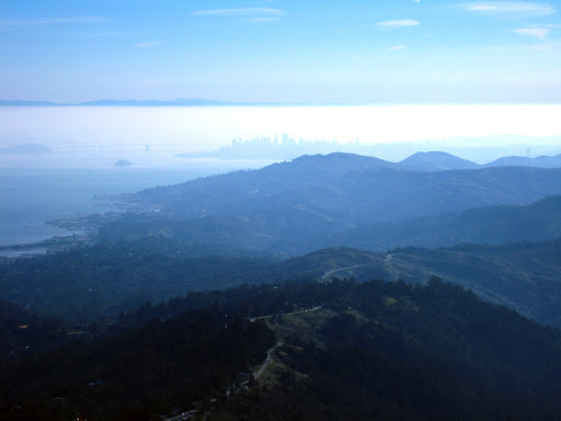
Panoramic Highway view of San Francisco
There is no place to pass anywhere, but with luck you won't be stuck behind a road boulder, since traffic is light. Enjoy the scenery which is spectacular after the morning fog dissipates. The pavement can be rough in some parts, so proceed carefully.
Panoramic Highway reconnects with Highway 1 at Stinson Beach, where you can stop and enjoy the beaches of clean sand; load up on coffee and groceries, but not on gas.
View of Stinson Beach
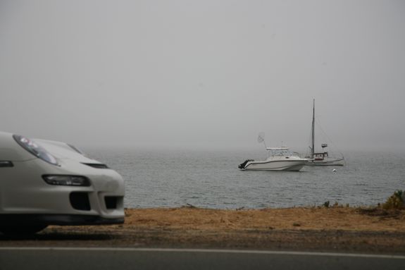
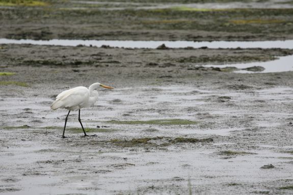
Past Stinson Beach, the road follows the edge of the Bolinas Lagoon. Pull over and take a look at the beautiful waters and the birds. If you brought your fishing rod along, this is a great spot to tickle the fish.
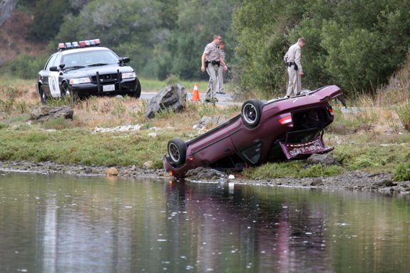
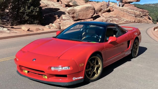
Visibility is decent, the pavement is good and the curves are predictable, but don't go too fast, as the consequences may be dear. The young man in the picture below found out the hard way. Everyone was fine, but the car was not.
When the Bolinas Lagoon disappears in your rearview mirror, you enter the Olema Valley and are treated to 10 miles of clean pavement through the Point Reyes National Seashore. Speed through this area is fairly good but the scenery is worth slowing down for. Forested sections and sharp turns alternate with long straights along grassy pastures. Going through the town of Dogtown, population 30, you will see neither dog nor human. Maybe they will be back by the time you get there.
Take a look at the map above. The Olema Valley - from Stinson Beach to Point Reyes Station -- and Tomales Bay to the north make a nice straight line that marks the San Andreas Fault. Point Reyes is moving north at the rate of about an inch and a quarter per year. Come back in a few million years, and Bolinas will be in Canada.
In Olema, keep going straight on Highway 1, unless you are tired already and want to head back to San Rafael on Sir Francis Drake Boulevard. The next town is Point Reyes Station. As the murals on the wall of the post office depict, it was once a stop on the North Pacific Coast Railroad. However, don't expect a romantic steam ride; the last train came here in 1933. Cheda's Garage at the southern end of town is the oldest AAA establishment in California. The town is full of restaurants patronized on week-ends by bicyclists, motorcyclists and locals alike.
One notable feature at the north end of town is the only stretch of road that features both a dashed yellow line and proper visibility. Make good use of it as needed. Continuing north, Highway 1 winds its way between Tomales Bay on the left and dairy farms on the right.
In season you can stop and buy oysters in Marshall, population 50, fresh from the boat that brought them in. Oysters are best between October and February; try a cold Marlborough County Sauvignon Blanc from New Zealand with them.
Between Marshall and Tomales, the pavement is pure bliss. The road turns east along Keyes Creek and arrives in Tomales at mile 46. Tomales is another small village, former home of Coast Miwok people, and most notable today for its collection of century old buildings. Nothing too stuffy though, you will even find a bit of that Marin County eclectic we all love. The William Tell House features an English telephone booth and an Italian menu. Go figure. The bakery at the intersection of 1st Street has good pastries and coffee. Across the highway, the Continental Inn has nine guest rooms. Plan on staying a while.
Fabulous blog!
ReplyDeleteLast spring my partner and I drove from LA to Monterey in 4 days using only back roads and the PCH. I can't wait to follow a few of your routes!
Thanks for all your efforts.